An Angular 7 plugin that allows:
| Options | Type | Default |
|---|---|---|
| country | string[] |
[] |
| countryColors | string[] |
[] |
| googleAPIKey | string |
'' |
| Options | Type | Default |
|---|---|---|
| googleMap | boolean |
true |
| zoomMap | number |
6 |
| styleGoogleMap | string |
silver |
| strokeCountryColor | string |
white |
| strokeCountryWidth | string |
1px |
| markerColor | string |
orange |
| listPoints | PointVM[] |
true |
| openModal | boolean |
false |
| modalWidth | number |
30 |
| Options | Type | Default |
|---|---|---|
| city | string |
'' |
| address | string |
'' |
| type | string |
marker |
| Value | Type | Country |
|---|---|---|
| IT | string |
Italy |
| UK | string |
United Kingdom |
| USA | string |
USA |
| F | string |
France |
| D | string |
Germany |
| E | string |
Spain |
| N | string |
Netherlands |
| PRT | string |
Portugal |
| CHE | string |
Switzerland |
| IND | string |
India |
| BRA | string |
Brazil |
| J | string |
Japan |
| AUS | string |
Australia |
| A | string |
Austria |
| HR | string |
Croatia |
| CZ | string |
Czech Republic |
| DK | string |
Denmark |
| EST | string |
Estonia |
| FIN | string |
Finland |
| IS | string |
Island |
| IRL | string |
Ireland |
| PL | string |
Poland |
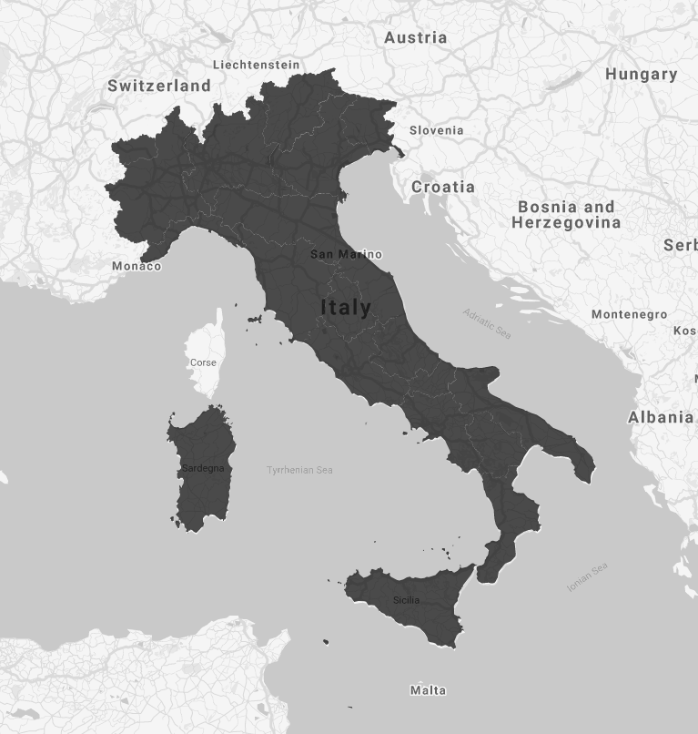
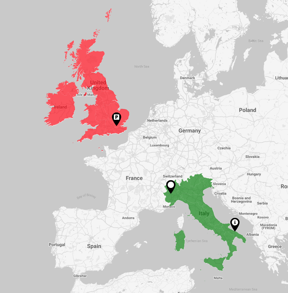
true the google map is displayed along with the customized map of the various countries. If the value is false, only the first nation image of the country array is displayed.
#### `zoomMap`
This value sets the zoom level of the google map.
#### `styleGoogleMap`
This value sets the style of the google map. Allowed values are:
- `silver`
- `retro`
- `dark`
- `night`
- `aubergine`
#### `strokeCountryColor`
This value sets the color of the line that separates the various areas of the displayed countries. It is used only if googleMap is set to false.
#### `strokeCountryWidth`
This value sets the width of the line that separates the various areas of the displayed countries. It is used only if googleMap is set to false.
#### `markerColor`
This value sets the color of the map marker. Allowed values are:
- `orange`
- `white`
- `black`
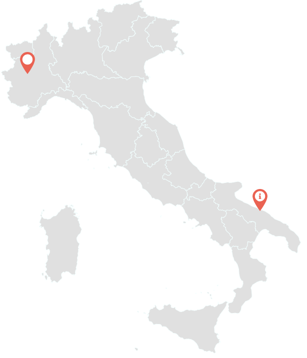
#### `listPoints`
This array contains the list of the various points to display on the map. it's an array of PointVM type.
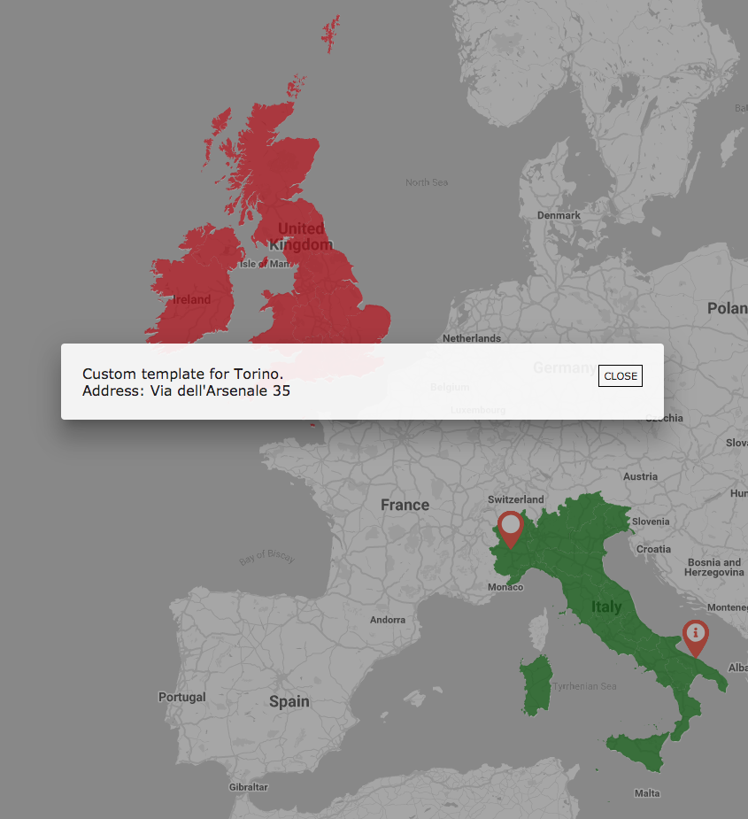
#### `openModal`
If the value is true when a marker or area is clicked, a modal is opened that uses the template that is passed to it. If it is false, the value in output is received through (clickPoint) and (clickArea)
#### `modalWidth`
This value sets the width of the modal. It is used only if openModal is set to true. Note that this value is in percentage.
## PointVM Attributes Map Details
#### `type`
This value indicates the type of pin to be used for places. Allowed values are:
- `marker`
- `info`
- `parking`
- `restaurant`
#### `city`
This value indicates the city.
#### `address`
This value indicates the address of place.